
The following post is a portion of the Leaflet Tips and Tricks book which is free to download. To use this post in context, consider it with the others in this blog or just download the the book as a pdf / epub or mobi .
----------------------------------------------------------
----------------------------------------------------------
Esri World Imagery
The Esri World Imagery tiles are an outstanding set of maps that are made up of a combination of photo imagery sets of the Earth at different scales.
The tiles are distributed by the good folks at Esri who also support a range of other excellent tile sets.
URL Template
The following URL template may suffer from word wrapping in your electronic publication format. It may therefore be better to get a more accurate copy from an online version which can be found here in Github or from the visual version on bl.ocks.org.
http://server.arcgisonline.com/ArcGIS/rest/services/World_Imagery/MapServer/ti\
le/{z}/{y}/{x}
http://server.arcgisonline.com/ArcGIS/rest/services/World_Imagery/MapServer/ti\
le/{z}/{y}/{x}
Usage policy
Esri has a full terms of use statement here and a human readable version here. It boils down to making sure that you understand the typical usage of the tiles as well and the organisation that is using them (there are different conditions for Government, Education, and NGO users). There are also good common sense rules on bulk downloading and redistribution (don’t do it).
Attribution
Because there is a wide range of imagery used in the tile set, there are a lot of organisations that require attribution. This includes Esri, DigitalGlobe, GeoEye, i-cubed, USDA FSA, USGS, AEX, Getmapping, Aerogrid, IGN, IGP, swisstopo, and the GIS User Community. Of course if you’re going to make a small map, that list is going to wrap at the bottom (as in the example picture below), so if you don’t want that, you will want to come up with an alternative arrangement.
Usage example
The following script may suffer from word wrapping in your electronic publication format. It may therefore be better to get a more accurate copy from an online version which can be found here in Github or from the visual version on bl.ocks.org.
mapLink =
'<a href="http://www.esri.com/">Esri</a>';
wholink =
'i-cubed, USDA, USGS, AEX, GeoEye, Getmapping, Aerogrid, IGN, IGP, UPR-EGP, \
and the GIS User Community';
L.tileLayer(
'http://server.arcgisonline.com/ArcGIS/rest/services/World_Imagery/MapServer\
/tile/{z}/{y}/{x}', {
attribution: '© '+mapLink+', '+wholink,
maxZoom: 18,
}).addTo(map);
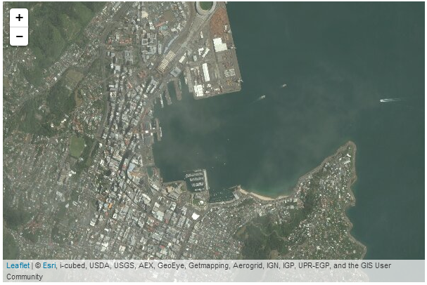
Esri World Imagery map
mapLink =
'<a href="http://www.esri.com/">Esri</a>';
wholink =
'i-cubed, USDA, USGS, AEX, GeoEye, Getmapping, Aerogrid, IGN, IGP, UPR-EGP, \
and the GIS User Community';
L.tileLayer(
'http://server.arcgisonline.com/ArcGIS/rest/services/World_Imagery/MapServer\
/tile/{z}/{y}/{x}', {
attribution: '© '+mapLink+', '+wholink,
maxZoom: 18,
}).addTo(map);
|
| Esri World Imagery map |
No comments:
Post a Comment